Where Hamburg is like Venice! A compendium of the city’s most beautiful canals
Venice, please don’t take this the wrong way, you old lagoon city in the north of Italy! You’re a magical place. But do you know that here, in the north of Europe, you have an equally beautiful sister named Hamburg? Sometimes she even gets confused with you. Although this may sound absurd to you and you two are not really siblings, there are some similarities between you and HER. And they have to do with a lot of water…
TEXT & PHOTOS: SUSANNE KRIEG

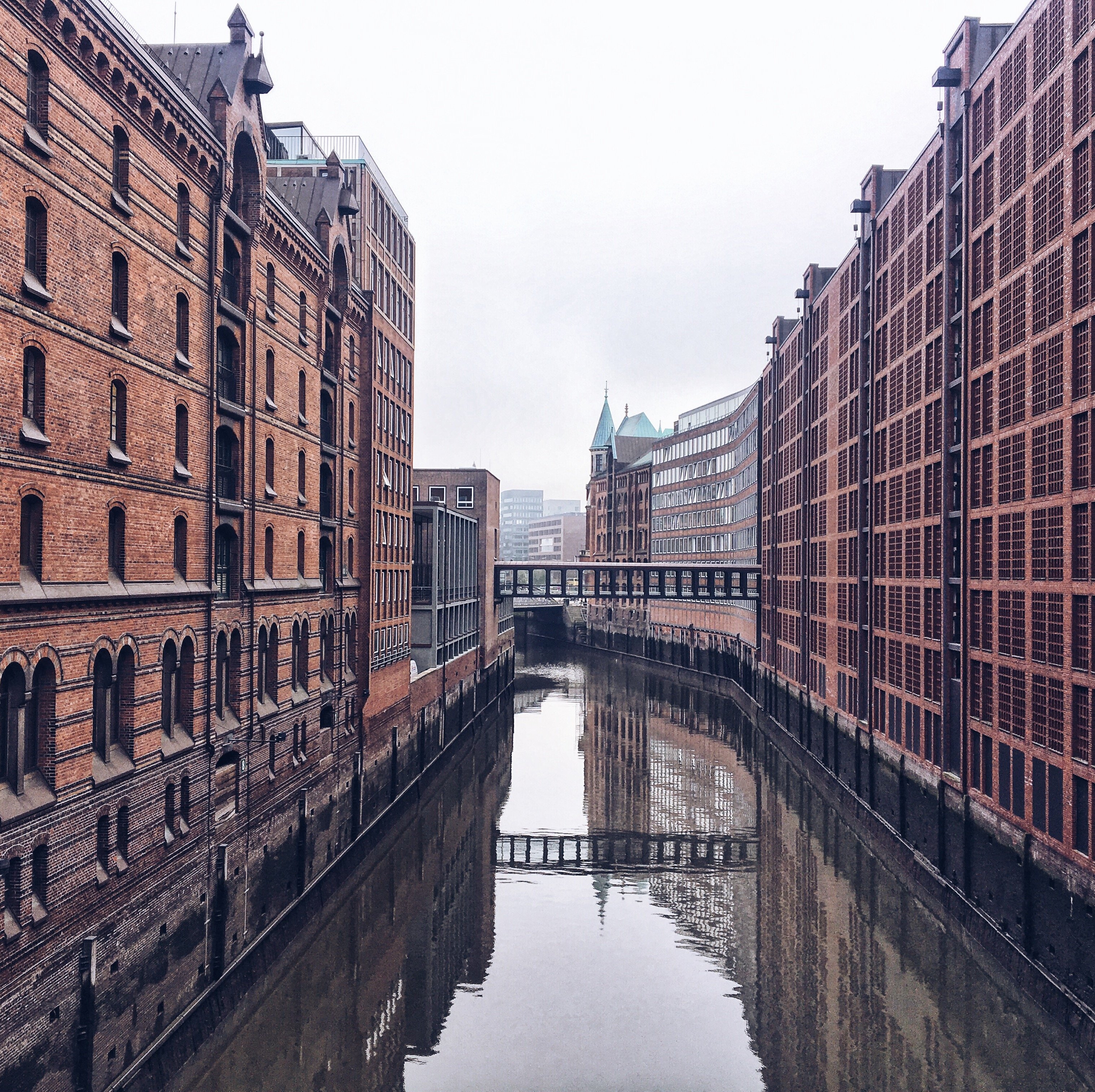
Brooksfleet
Some time ago I came across a photo at the stockfoto platform Pixabay. It shows – as you can see here – the Brooksfleet, a canal in the middle of Hamburg’s Speicherstadt, only in the opposite direction. The picture was titled “Venice” instead of “Hamburg” – and that’s still the case, a piece of “fake news”, which has survived until today, although not only me but also other smartass guys tried to get it right…. The lesson learned? Don’t believe everything you read on the internet! But instead you may believe ME now that for some people Hamburg and Venice really look like each other!
→ For location please click here: Google Maps

Poggenmühlenbrücke
The bridge, on which you can see my red speedster parked here, is undoubtedly one of Hamburg’s most popular instagram locations. It may be due to the “Wasserschloss”, a castle, which presents its chocolate side from this perspective: surrounded by mighty storehouses, it sits enthroned on one of the many islands on which Hamburg’s Speicherstadt was built. In the building, in which no prince resided, but normal port workers, you will find a tea shop today. Plus a restaurant. However, its reviews are mediocre – as almost always when the location is outstanding. But back to the bridges: There are three in this picture alone. Like the Venetians, the people of Hamburg love the many bridges that help them to overcome all the city’s waterways. And we like to brag that there are 2500 of them in Hamburg. Yes, we often emphasize that there are many, many more than in Venice, where there are only a little more than 400…. But don’t worry, dear Sernissima, because, to be honest, it’s not a very big trick: after all, Hamburg is much bigger than you. The comparison is therefore simply unfair.
→ For location please click here: Google Maps

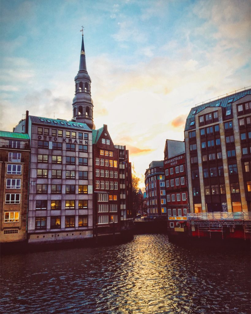
Mönckedammfleet
The Mönckedammfleet is a curve of water, stone and mirror images. The buildings remind me of the famously curved circus of the English town of Bath. The Canal Grande is also a single curve, so you know what I’m talking about, dear lagoon town. But have you ever seen a canal over which a subway runs like a looping track? In this case, it does so because the U3 metro line changes from an elevated railroad to a tunnel just behind Rödingsmarkt. The wagons are suddenly submerging like Captain Nemos Nautilus. But a few stations later, at the Berliner Tor, they rush from the depths back to the surface.
→ For location please click here: Google Maps

Herrengrabenfleet
A network of 22 canals spins just around the Alster. One of them is Herrengrabenfleet, a former defence ditch. Its name is reminiscent of a privilege: only mayors and councilmen were allowed to catch fish here. Of course, there were ssimilar privileges in the Venice of the Doges, where everyone was chopped off his hand, who dared to plant a wooden stick in the lagoon without permission. At Herrengraben you can still find beautiful old office buildings and warehouses. But recently also hobby anglers. They are allowed to throw their rods into the water with impunity. Carps, eels, large river mussels: the seemingly murky water is even more species-rich than previously thought. And with the help of underwater willow balls and fish ladders, the Hamburgers now also want to reintroduce sea trout, lampreys and other migratory fish. PS: The lead picture of this post also shows the Herrengrabenfleet with a view of the Ellerntorsbrücke.
→ For location please click here: Google Maps

Nikolaifleet
Fleet or canal? And what exactly does the word “Fleet” in German mean? I can reassure you, dear Venice, even many Hamburgers don’t know that. I didn’t know either. But I informed myself only for you. All right: Unlike the canals, the Fleet was originally dependent on the tide, and its water level fluctuated with the tide. Many of the Fleete were gone in the 19th century. In the remaining ones, locks regulate the water level today. The word Fleet comes from “fleten”, as they used to say in medieval German, when they meant “flow”. So it has nothing to do with the English term “fleet”. Any more questions? Nope. Then let me tell you one more thing: that the most beautiful Fleet of Hamburg in my opinion is the Nikolaifleet shown here. And if you want to know another secret: it reminds me a little bit more of Amsterdam than Venice…
→ For location please click here: Google Maps
Reimersbrücke
The Nikolaifleet (here with Katharinenkirche in the back) is large. So big that in the 12th century it was the nucleus of the Port of Hamburg. At that time it connected the Alster and Elbe, like your Canal Grande the lagoon with the basin of San Marco. On old photos of it you can see the flat barges, called Schuten and Ewer. At that time, they transported goods from the large sailing ships through the narrow waterways to the office buildings. Unlike your gondoliers, the Ewerführer of Hamburg did not move their boats by paddling forward. Rather, they put long hooks in holes at the edge of the Fleet walls to pull the boats forward. Sometimes goods and a lot of garbage went overboard. At low tide, often at night, so called “Fleetenkieker” with waders and lanterns stomped through the mud. These bitterly poor ancestors of Hamburg’s public waste removal earned an extra income by cleaning the canal and hoped for reusable finds at the same time.
→ For location please click here: Google Maps

Rondeelteich
A paddling tour in Hamburg is a voyeristic adventure. The canals and Fleete above the Alster often lead through noble districts, where the gardens of the villas line the banks like colossal pie pieces. If you want to have a picnic on the water on a beautiful day and want to secretly check out the residences of the rich, you can rent wooden canoes, dragon boats, kayaks, pedal boats, catamarans – and even gondolas. Yeah, you heard right! Genuine Venetian polished gondolas, led by a Venice trained gondoliera. Women at the steering wheel of a gondola – yes, this really exists only in Hamburg!
→ For location please click here: Google Maps

Kibbelstegbrücke
The place where I personally think Hamburg is most likely to be like you, Venice, is the Kibbelsteg bridge in Speicherstadt. Maybe it’s the green water, maybe the old walls. Whenever I stand on this bridge in the rain, I expect Comissario Brunetti to meet me and solve the real problems of humanity. Incidentally, the Kibbelsteg bridge is one of the longest in the Speicherstadt and connects Hamburg’s Old Town with HafenCity. The upper part is the official escape route in times of severe floods, or l‘ aqua alta, as you call it. The worst storm surge of recent times caught up with hurricane Xaver in 2013. But the Kibbelsteg kept its promise: thanks to its double-decker construction, police cars, ambulances and the fire brigade were able to pass it comfortably.
→ For location please click here: Google Maps